Midway Mine, Mile 710, Alaska Hwy Near YukonBritish Columbia Border
Here are photos I took last summer, of an old abandoned mine located in British
Columbia, Canada. The Mine is called "Midway Mine", and has been closed for I
believe around 10 years now.
The road in to Midway is actually located in the Yukon Territory, about a 15
minute drive south of a little stop called Rancheria (Mile 710 on the Alaska
Highway).
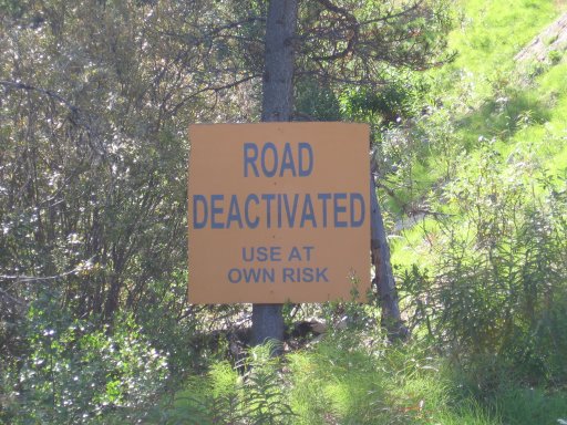
Trespassing Signs: "Road Deactivated" Signs 20km (12.5miles) up the dirt
road, no signs posted at the entrance to the road (see photo below)
Patrolled: No, the only way to access it is by ATV or Snowmobile
Personally Visited: Yes, August 19th, 2007
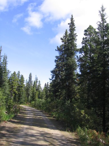
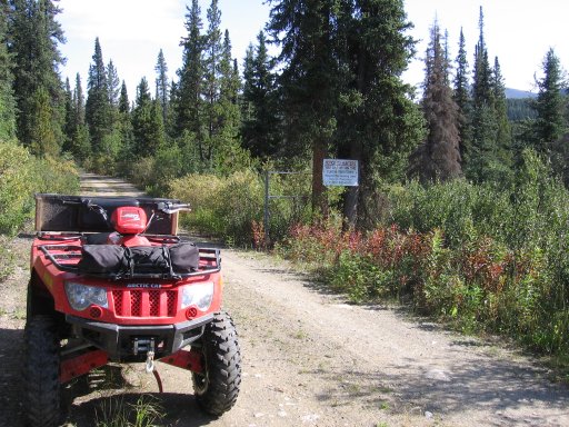
Road into Midway. You can enter by car or truck, but you can't make it all the way to the mine, you'll see why shortly. The area and road is generally used by hunters now. It's a old dirt mining road.
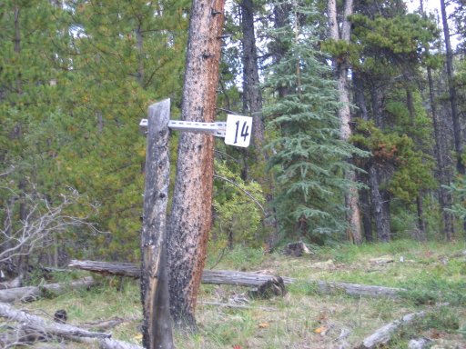
Every kilometer into the mine you will fine these markers pinned to trees.
This is KM 14, meaning you are now 14KM down the mining road from the main
highway. These were used by truckers to warn each other if and when they were
coming down the road, as it is barely a one lane.
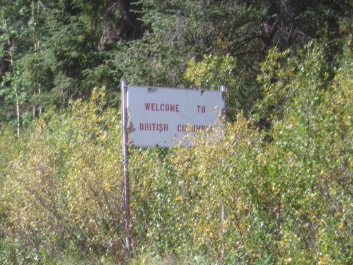
Just after KM15, you are greeted by this sign. You have now left the Yukon and have entered BC.
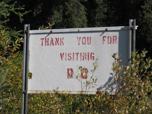
The other side of the sign. Note "Visiting" is spelled wrong.
Across from the welcome sign. This sign is much newer.
You can see a partial gate by the sign.
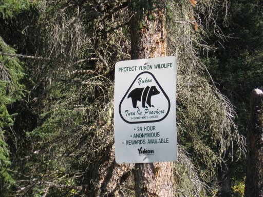
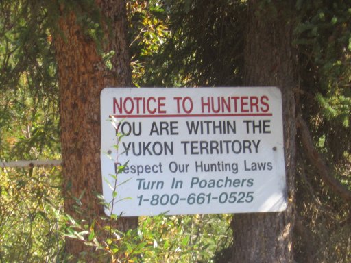
Another Yukon Hunting sign.
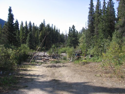
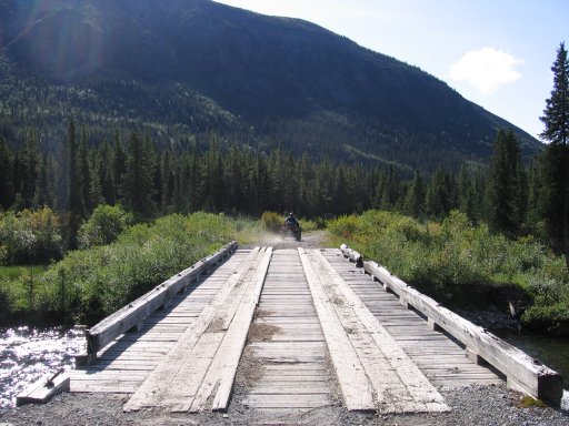
At KM 18, this is as far as you can go by truck or car. The bridge has been
either destroyed, or washed out. However it is easily crossable by ATV, if you
don't mind getting your feet wet. The little tepee structure was probably built
so people don't go blindly driving into the creek in the dark.
KM 19, This bridge is intact, and very stable. It looks very well built.
KM 20, you go down a hill, and are greeted by two very large signs.
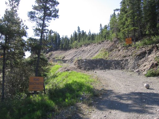
The road has been blocked off by not one, but four very large gravel mounds, to prevent any access to the mine site. Looking closely on the left, you can see trails have been made to access it by ATV.
It very dangerous to go over the four mounds, as it is a major drop to the bottom on the left hand side.
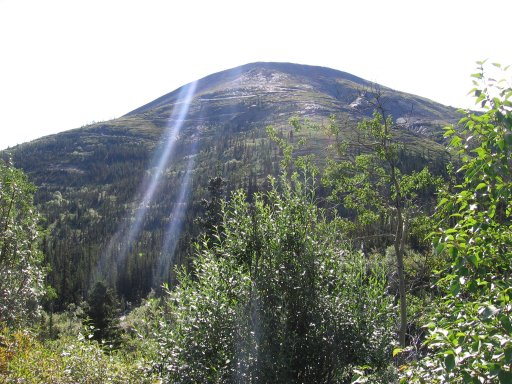
KM 25, arriving at Midway. You can see roads weaving up the mountain. These are made for Cats or other heavy equipment, the roads are much to steep for an ATV to travel (we tried).
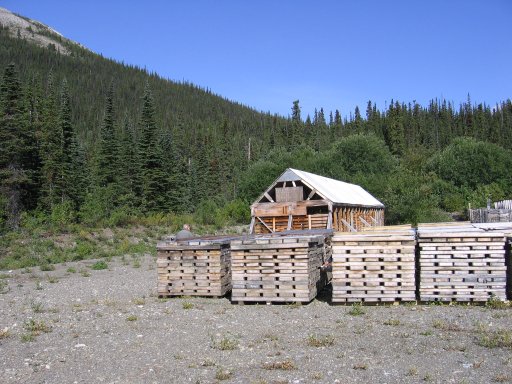
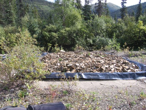
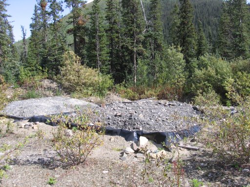
Not many actual buildings left, mainly Core Boxes and Iron Rod storage units.
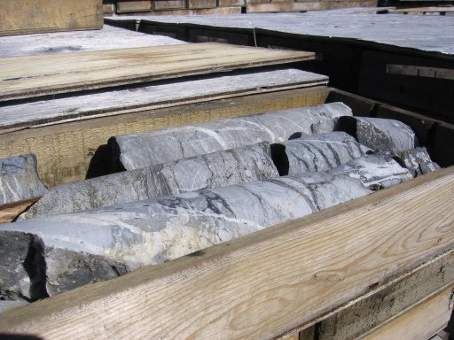
Each stack of core boxes contain core samples.
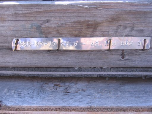
And are labeled by date, sample, location, etc. If I'm reading them right, these were done in 1997.

Angle Iron rods neatly stacked.
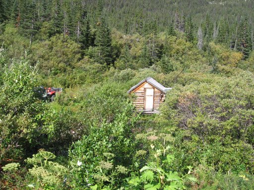
KM 26, up the road from the mine, hidden within the brush is a small building.
It's a sauna, which must still be usable, as we saw tour books form 2004 inside.
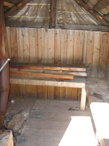
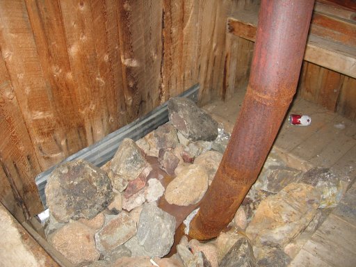
Inside the sauna.
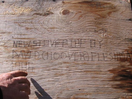
The door on the sauna. Looks to have been built in 1984, and a new stove pipe installed in 1986.
Outside of the sauna, a small creek.

More iron boxes and core boxes near the sauna.
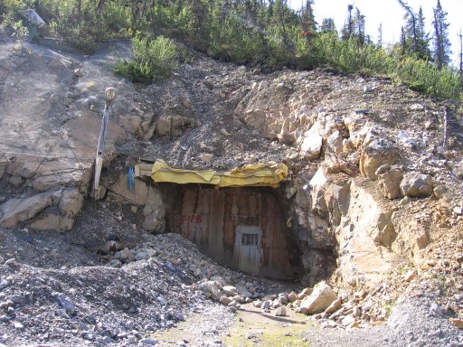
Back down to KM 25, this is the mine entrance, sealed off with a door. The lock on the door however was smashed off. You can how over time it's been slowly caving in. The light fixture is still intact, but of course there's no generator to power it.... You can see the word PIPE with an arrow, pointing at a now buried pipeline under the rocks.
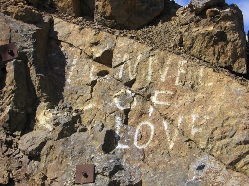
The wall beside the door. Someone has a sense of humor huh?
(you may need to adjust the brightness of your monitor to see these)
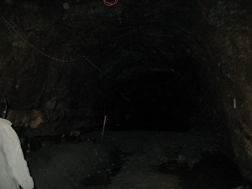
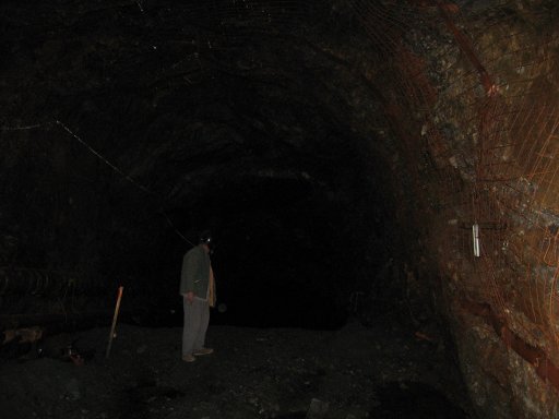
Peeking inside the mine. We didn't have a flashlight, so this was taken only
with the flash of the camera.
(you may need to adjust the brightness of your monitor to see these)
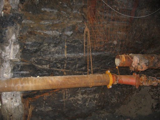
Rusted pipes on the wall of the mine.
(you may need to adjust the brightness of your monitor to see these)
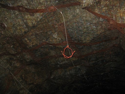
Old rusted mesh, pretty much the only thing keeping the mine from caving in.
(you may need to adjust the brightness of your monitor to see these)
Looking closely at the back, you can see a drop off. Next time, we bring
flashlights to explore more.
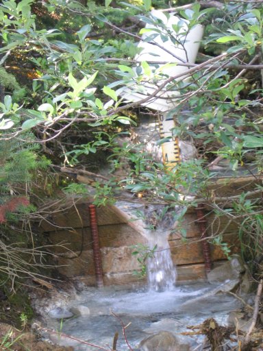
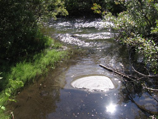
Near the mine is a small creek, they were testing the water.
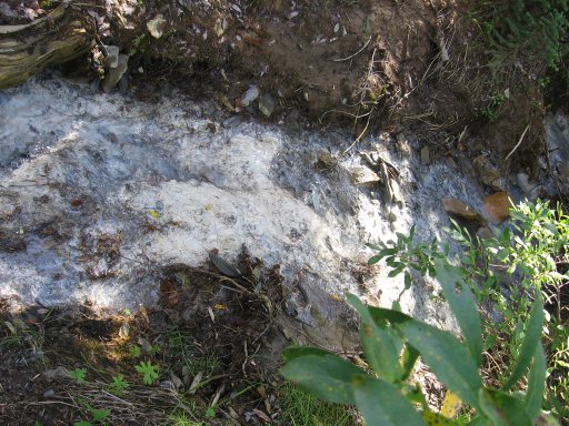
Unknown white gunk in the creek neck to the bucket, possibly calcium, or lime.
Leech pits, where they would dump various chemicals over the rocks to see
what would happen.
There was a sign just before these pits on the ground that read "WARNING.
EXPLOSIVES. NO SMOKING." Scary.
I'm hoping to return this summer, this time- with a flashlight!
To contact Abandoned But Not Forgotten please e-mail us at abnfco@gmail.com with any submissions you may want to contribute to the site.
 View my Guestbook
Check out our Forums