Back to Massachusetts Page
Francis Cabot Lowell History and Pictures
This page will take awhile to
load
Pictures used with permission from
corey.sciuto@gmail.com
Original link
http://home.comcast.net/~corey.sciuto/lowell.htm
I had nothing to do this afternoon, so after the Cribs thread,
I thought I'd take a walk and show off the thriving metropolis in which I live.
Lowell, MA is located 30 miles northwest of Boston at the confluence of the
Merrimack and Concord rivers. Its namesake is Francis Cabot Lowell - a product
of the Cabot and Lowell families, as blue-blooded as they came in 19th century
Boston. Lowell went to England, stole some textile machinery plans, and came
back to America. He prototyped his textile manufacturing machines in a few New
England towns, and then died. His associates headed up to East Chelmsford, where
the ridiculously fast-flowing Merrimack dropped 45 feet over the course of a
mile. There was a canal here already to avoid the rapids, and another that
linked the area with Boston. Realizing that much water falling that fast is
exactly what they needed for their "experiment", they hired as many disposable
Irishmen as possible and went to work in the 1820s.
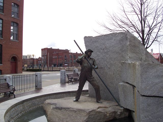
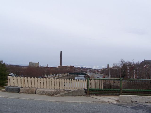
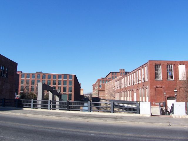
This statue commemorates the Irishmen who built Lowell's 6 miles of power canals
between 1820ish and 1850ish. The Lowell power canal system remains the largest
in the world to this day.
Now, all they needed were people who would be willing to work the new factories.
Wanting to be unlike England, where poor, uneducated types worked for starvation
wages, they brought in Yankee mill girls and set them up in company housing. Of
course, capitalism stepped in within a few years, and taking advantage of the
Irish Potato famine, Irish men, women, and children were employed...to work
insane hours at a dangerous job for starvation wages and receive no education.
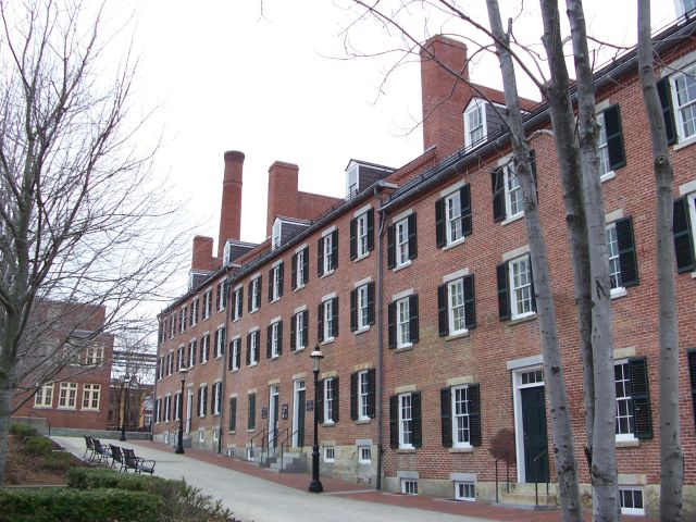
Here's one of Lowell's few remaining blocks of boarding houses.
By 1850, Lowell was New England's 2nd largest city, and by 1950, it was in deep
shit. Southerners and Mexicans are much cheaper than us New Englanders, and they
took our jeerbs. By 1978, Lowell was a real mess, and the Federal Government
picked up the Liberal program of making the "Cradle of the American Industrial
Revolution" America's first National Historical Park.
Today, Lowell largely continues to crumble around us, but yuppies have found
that it's a good place to live if you can't afford Boston, and is very close to
the Silicon Valley of the East Coast 15 miles north and west of Boston. The city
has seen massive improvement in some areas over the last 10 years. I'm actually
fairly legit here - my family has lived in or around Lowell for the most part
for the past 4 generations - as long as they've been in the US. Here's the
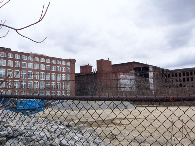
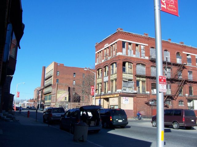
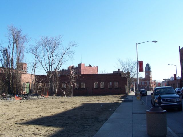
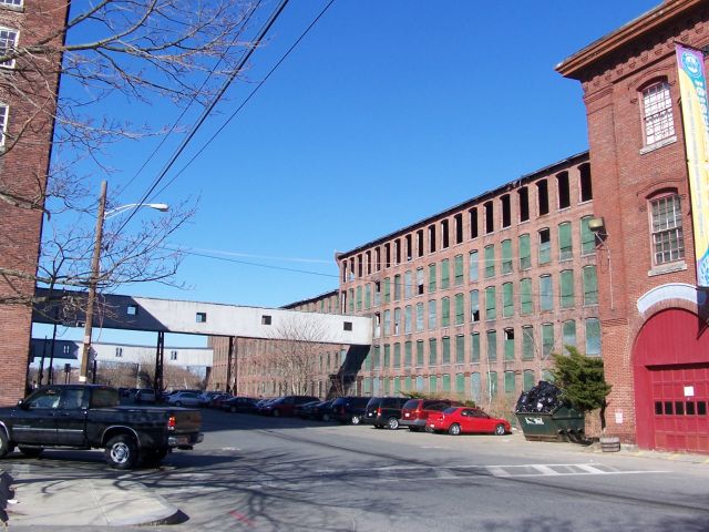
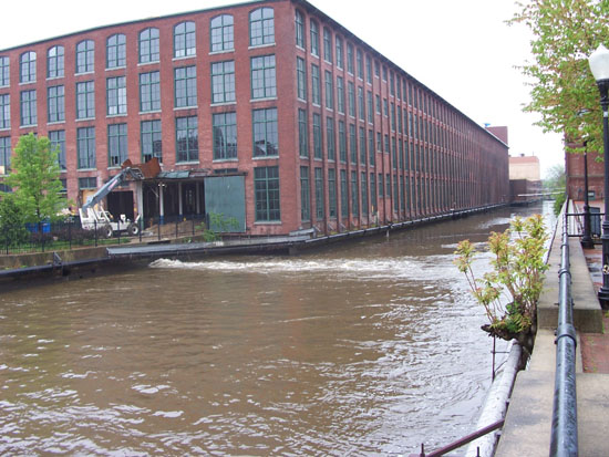
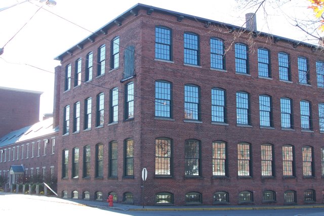
factory I live in, and the ruins of another complex just across a vacant lot and
a canal from me. It was partially torn down on purpose, since it's on a
peninsula of canals that is more like a moat, making it inaccessable to fire
trucks.
Today, I decided to go drop off some books at the library, walk along both banks
of the river, and then buy some guitar strings.
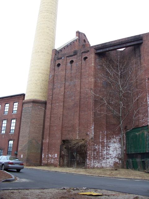
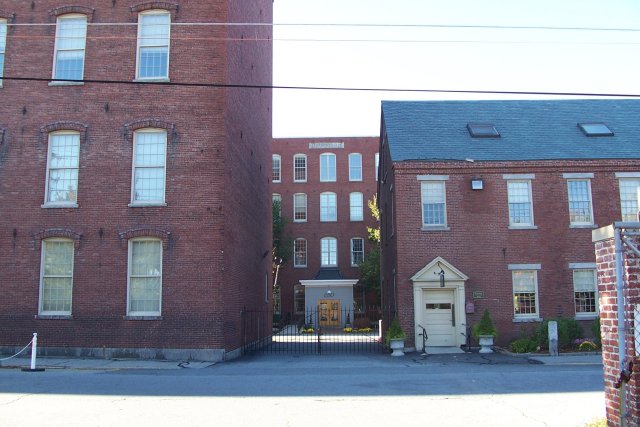
The coal shed outside my front door.
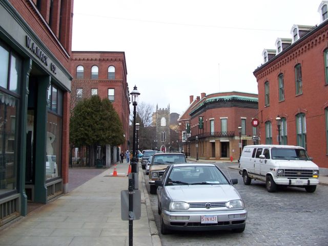
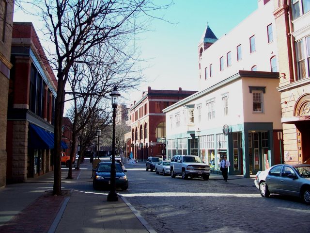
We enjoy cobblestones, since not only are they historic, they ruin your car and
jar out your teeth. The church at the end of this short street is about as old
as Lowell.
However, it was not to be a Protestant city. Here is St. Patrick's, the oldest
Catholic Church north of Boston, and a Greek Orthodox church, I think the oldest
Byzentine-Style church in America. The neighborhood they both stand in is called
The Acre, after the plot of land St. Patrick's is on. Fortunately for the Irish,
the Acre is an island due to the canals, and they were able to keep the
Protestants from burning down the original wooden church by defending the
bridges. Today, Lowell is America's 2nd largest Cambodian city, but I don't know
where their temples are.
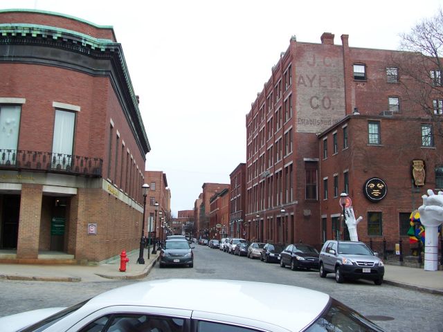
The New England Quilt Museum and the "Artist" run Ayer
Lofts.
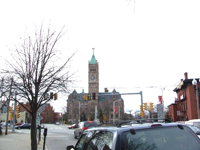
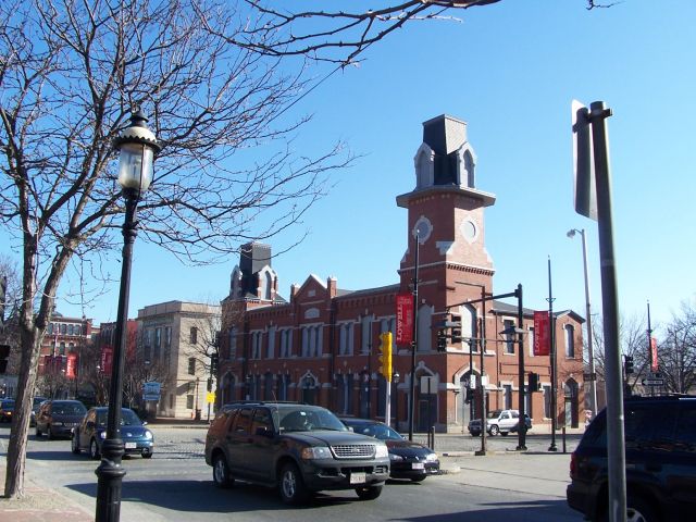
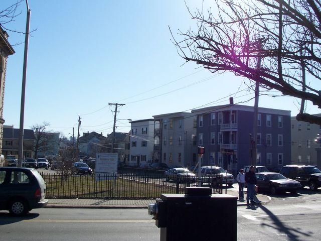
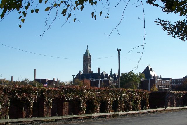
City Hall. A massive structure made of local granite (New Hampshire is 5 miles
away), the clock tower is said to have been built so tall so that workers at the
mills wouldn't get screwed out of wages by wrong clocks in the mills.
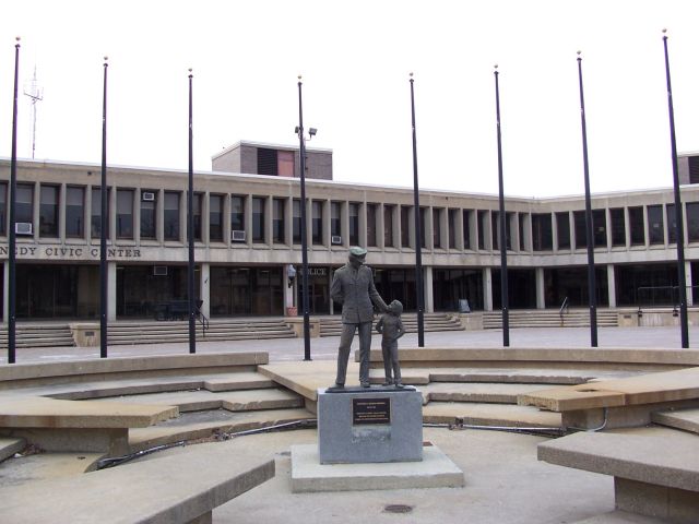
The JFK Civic Center. It's in Mass, of course it's named after JFK. A fine
example of 1960s-1970s thought processes, this disgustingly Brutalist structure
took the place of the beginning of Moody Street, a major road through Little
Canada, or the French end of the Acre. The end of Moody Street was replaced with
a parking lot, leaving the road cut off at both ends. The classic New England
triple decker housing that was in this neighborhood was replaced with suburban
brick tenements. This is the story of many of Lowell's inner neighborhoods. In
some cases, the city threatened homeowners with condemnation of the property,
which would allow the city to take the property by emminent domain for $1.
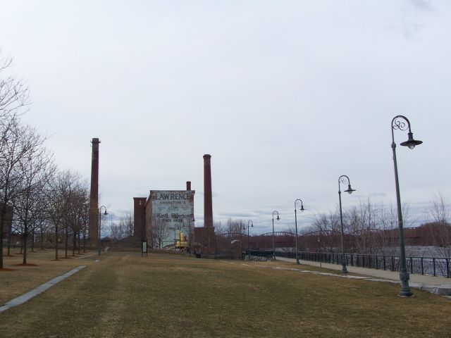
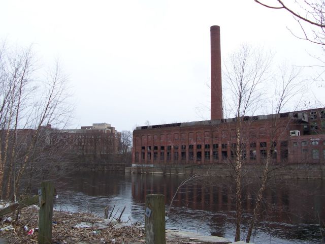
I dropped off my books and walked down to the Merrimack river. These are the
remnants of the Lawrence Mills. A massive fire destroyed much of this complex
when I was very young - I made my mom drive me here to see the ruins. The
remaining buildings are now becoming expensive condos.
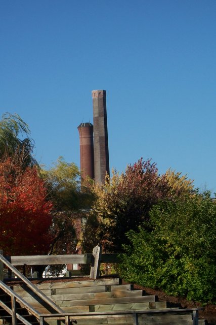
Note the smoke stack standing where no building is anymore. Really adds to the
Ambiance of these condos. Mr Lawrence I'm assuming is the guy who went downriver
15 miles and founded the city of Lawrence, which is a real hole. People who have
read history books probably know Lawrence as the place where the Bread and Roses
Rebellion took place in the early 20th century, forcing New England factory
owners to pay their workers and not have them work 20 hour days.
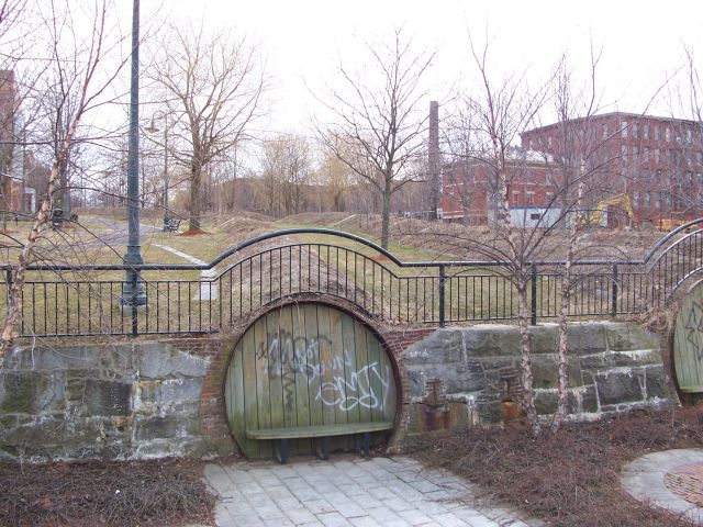
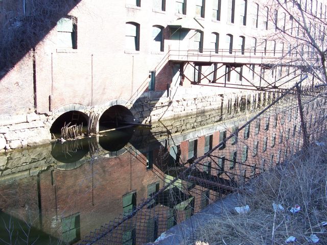
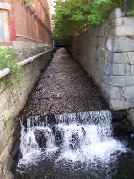
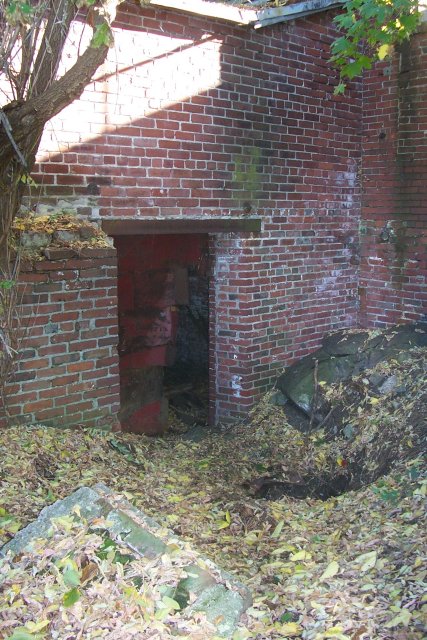
I'm assuming these blocked off tunnels used to channel water from the canals
under the mills (which are gone) and drop the water down into the water wheels
and turbines which powered these factories till someone found out about coal.
The canals are just about empty right now, since they were doing work on the
supports for one of the mills the National Park owns. There's a massive system
of locks that allows the water into different canals, or for some reason, the
can let it go in the river. The company that maintains the canals refuses to
clean the shit out of them, and promises to prosecute anyone who does it for
free.
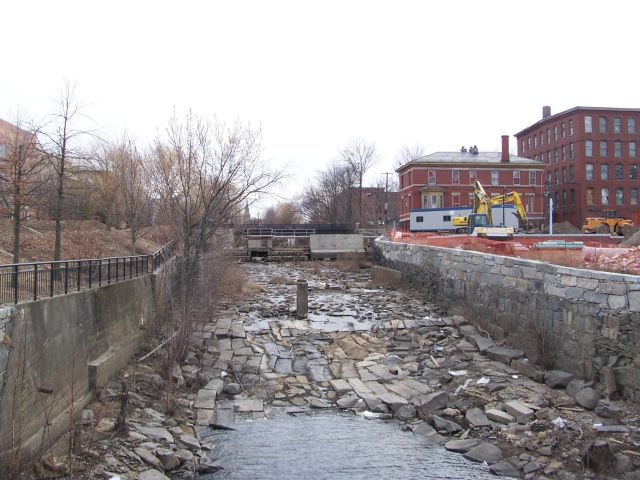
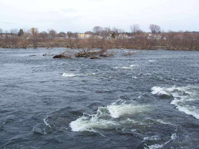
Like I said, with the canals empty, the river is really high right now. We're
probably halfway down the rapids (there's an actual dammed up waterfall at the
beginning that's probably only 10 feet high and I didn't want to walk that far).
It's hard to appreciate from these pictures how fast this water is going. Some
of the rapids in the Concord River, a smaller river that hits this river after
the canal system ends, are class 4 and 5 I believe. You can white-water them in
May.
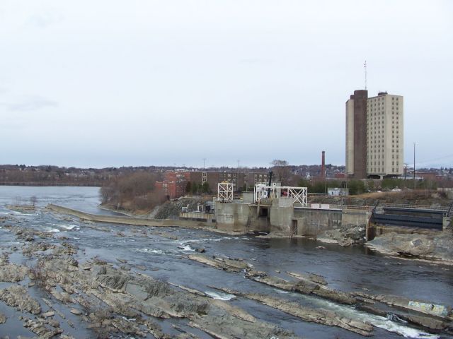
U-Mass Lowell, North Campus. This is the engineering college. That's a nuclear
reactor.
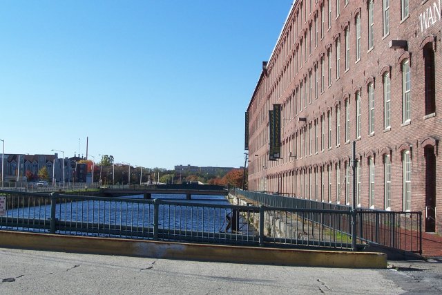
Standing over the Northern Canal. Left to right.low income housing tower
built on site of original mills, Wannalancit and Lawrence Mills, City Hall, Housing Projects in
Little Canada, and the roof of a closed, beautiful French-Canadian Catholic
church. Many of the bridges over the Northern Canal haven't been replaced since
they were built in the 1850s. I think I'm standing on one here.
I'm standing on the University Ave Bridge. The tall thing is a Lowell dorm.
Jack Kerouac, who was from Lowell (and they tell you that every time you come
into the city) wrote about standing on this bridge and watching a guy go crazy
and fling a watermelon off of it. Back then it was the Moody Street Bridge
-we're at the other end of the cut off street from the Civic Center. There's a
sign on the roof of a gatehouse off frame to the right saying "Save Kerouac's
Bridge!" They want to realign this bridge with a street instead of the parking
lot that they put there, tearing down another triple-decker and a 100+ year old
social club or something. The concrete thing on the river I believe is Boot
Hydroelectric that owns the canals. Signs in about 6 languages telling you not
to go in the water here. You go out on a rock and they open the locks, you're
going to die.
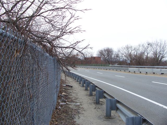
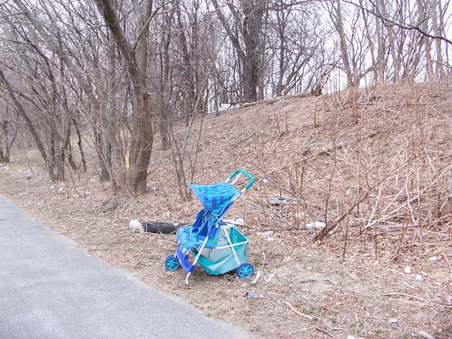
The VFW Highway - pretty quiet right now. They need to do something about this
walkway, it's a mess.
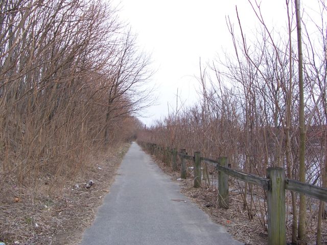
After crossing over a dead beaver that's been there a few weeks, a dead
something, and a dead rat, you can walk down the embankment to another
somewhat-overgrown walkway. This might look better in the summer, I don't know.
Those VFWs that the road is named after are living down here off to the left in
a tent-city.
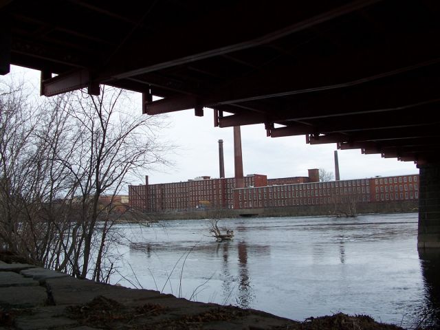
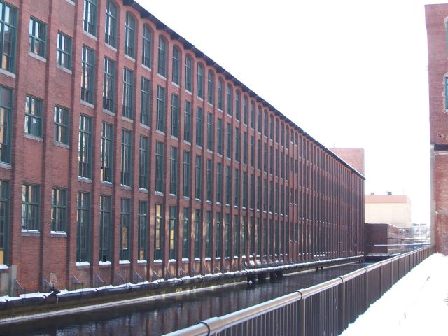
"Under the Bridge Downtowwwwwn" The brush clears up to get a good shot of the
Lawrence Mills here. Back in Lowell's heyday in the 1880s, from here on was "The
Mile of Mills." Many are now gone, but you can still get the idea of huge brick
factories and smokestacks with black soot going on for ... a mile. There were 10
major companies in Lowell by 1880, about half had riverfront property.
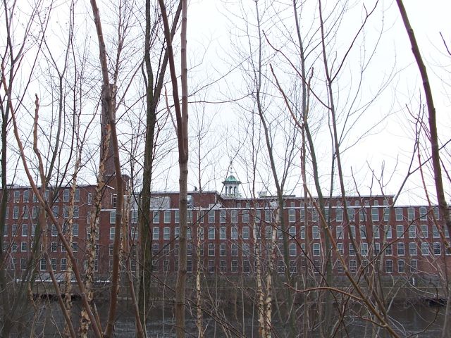
The Boott Mills through the brush - named after Kirk Boott, and important early
Lowellian. Kirk St is named after him, and not James T. as I thought when I was
younger. You can barely see to the left the hole in the retaining wall, this is
where the canal water would re-enter the river after powering the mills. Also of
note here is the white and green bell tower, by which the factory workers lived
their lives.
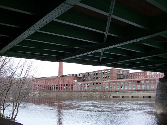
The Massachusetts Mills from under the creatively named Bridge Street Bridge
(now officially the Cox Bridge, the naming jokes in this city never end!) These
dilapidated mills next to the river are a source of debate. Zoning laws say that
there isn't enough parking to turn them both into condos. Nobody wants to tear
down one so the other can remain standing, so they're going to wait to see which
one collapses and destroys the renovated $1000+ month apartments in the rest of
the complex first.
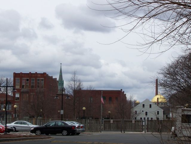
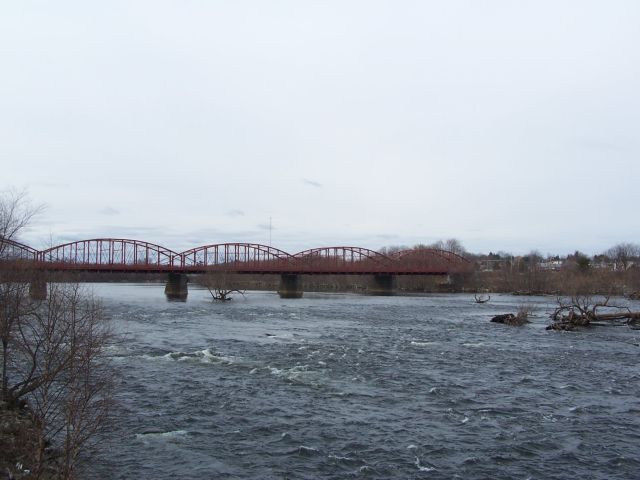
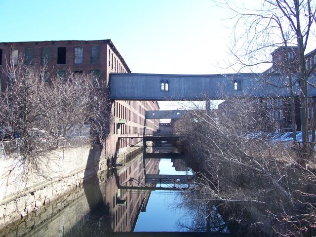
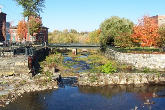
The end of the Mile of Mills, the Concord River joins the Merrimack. That's 'Kahnkid'
to those of you who don't live here. Across the river from the Mass Mills is
Saints Memorial Medical Center.
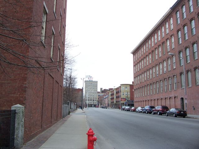
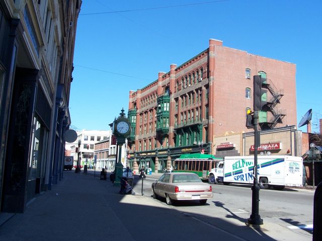
Bridge St, looking to Kearney('Kahnee') Square. Lt. Kearney was a military guy.
Probably not as famous (infamous) as Lowell's own Benjamin Butler from the Civil
War. Mass Mills on the left, then Kerouac Park. Lowell Sun building (actual
newspaper company is in the next building over, the tower has old people living
in it) at the end of the square, and then some buildings,
a diner, and the Boott mills on the far right. This square is the center of the
city. Famous Lowell commercial inventions - CVS, Moxie soda. Much better known
for its industrial inventions...
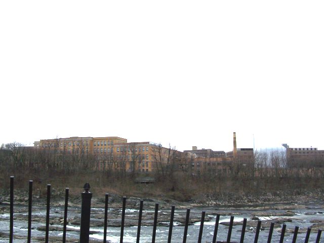
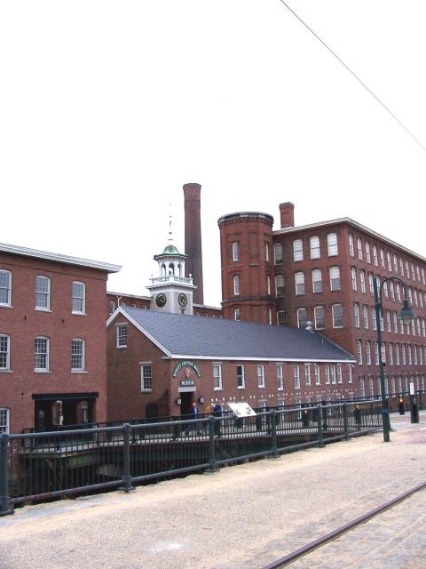
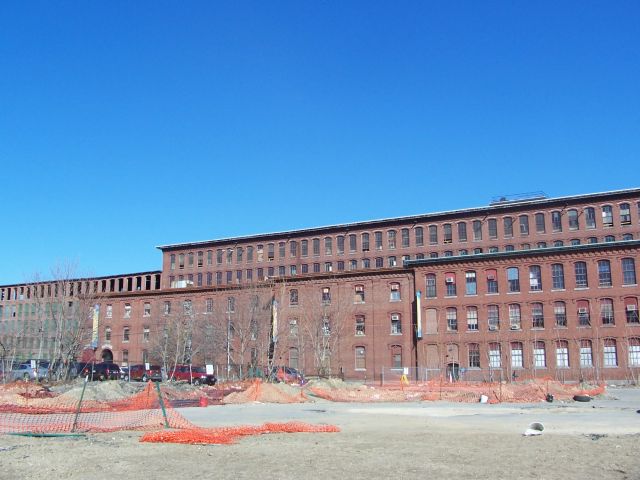
The Boott Mills, Lowell National Historical Park. These mills are very well
maintained...except as I mentioned they almost fell into the canal in front of
them a few weeks ago because supports eroded away. This is a well-known shot.
The smoke stack, the stair tower, and the bell and clock. Inside this building,
you can go into a weaving room and watched how the magic happened when your
great-grandma worked here.
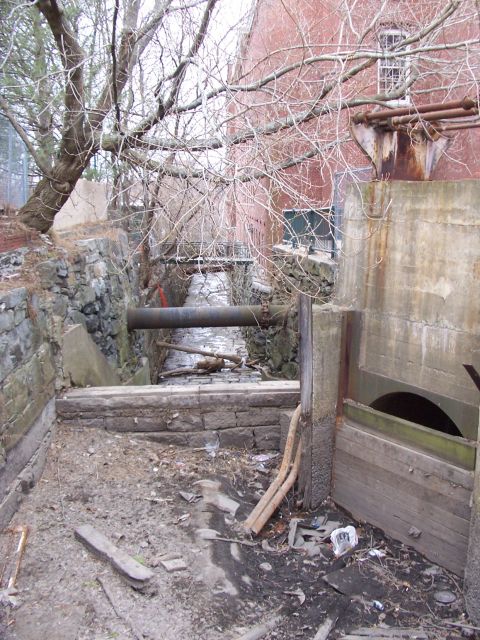
Goddamn it, get some water back in here!
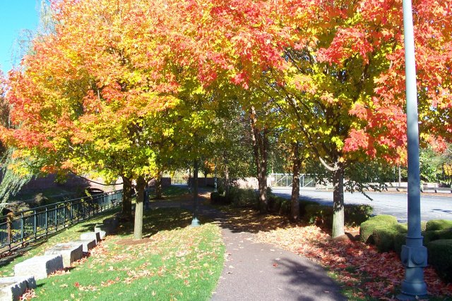
Lucy Larcom was a famous poet mill-girl in the early days of Lowell. I'm
standing on the linear Lucy Larcom Park. In front of me, the empty Merrimack
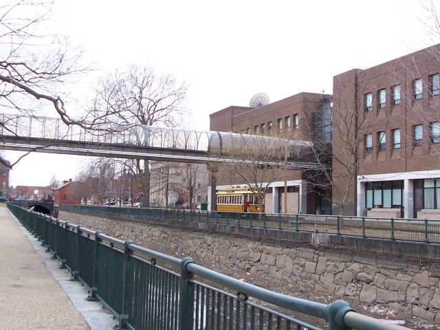
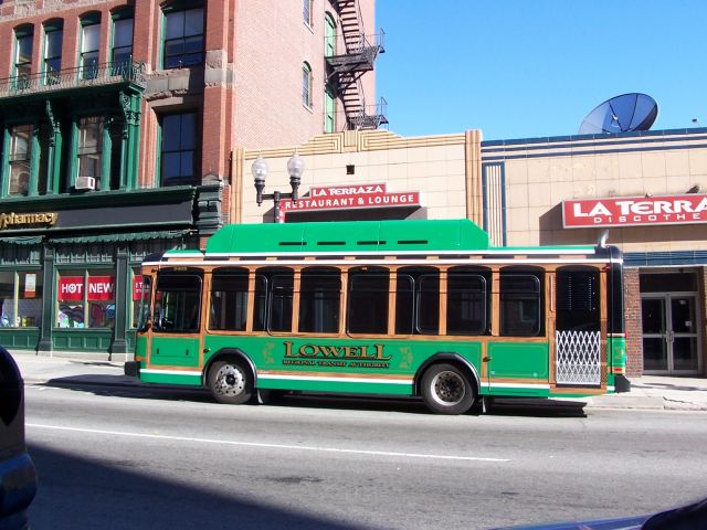
Canal (yummy). Across from that, the National Park trolley. Lowell
banned at-grade train crossings years ago, but the city's history with street
cars has been allowed to continue on this one trolley. Now, I'm all for using
your car as little as possible, and the car becoming American life probably did
as much damage to Lowell as the fleeing of industry to the South, but that thing
clangs around all day, blocking major roads. The building behind that is the new
part of Lowell High School. The old part is behind me, across the sky-way.
Lowell High is the 2nd largest high school in Massachusetts, graduating 750ish
students a year. Considering the dropout rate in this city, for grades 9-12,
that makes it HUGE.
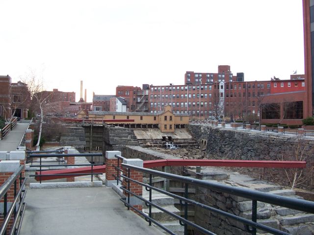
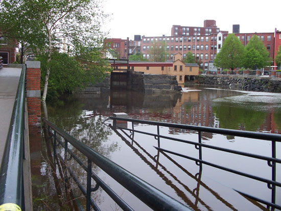
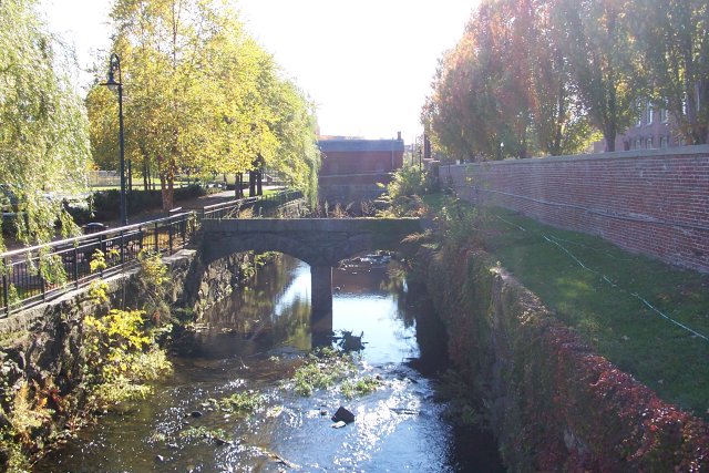
The Lower Locks. This is where the canal system rejoins the rivers. That yellow
building is the gatehouse, and there's a few more like it around the city,
controlling the flow of the water for power purposes and transportation
purposes. Although a barge probably hasn't used this canal since before 1850. In
the distance, you can see the roof of the coal shed I live by.
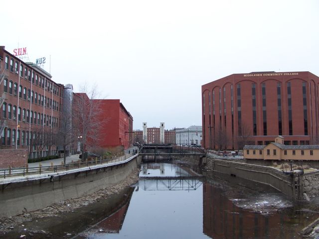
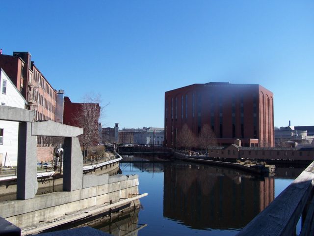
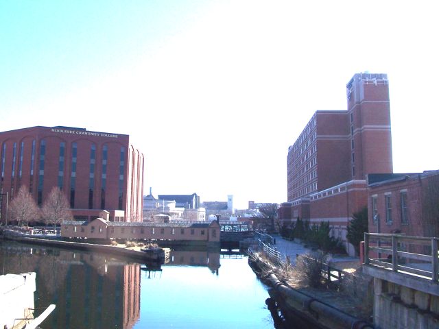
Sun Building's giant neon sign, Apartments at Mass Mills, Middlesex Community
College, Lower Locks Gatehouse.
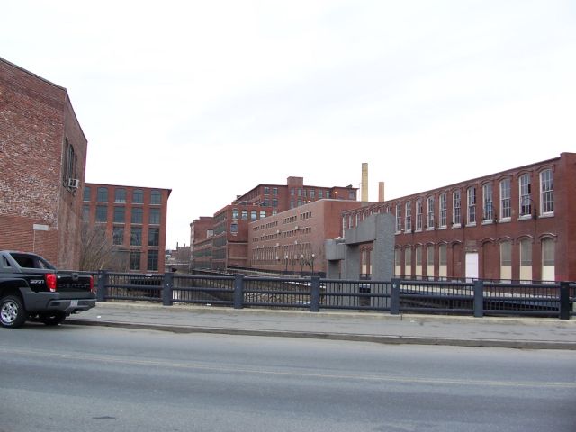
Industrial Canyon, Central St over the Pawtucket Canal. Lower Locks are behind
me. This is the backside of my condo complex to the right. Until recently, that
big factory on the left was a fabrics company still. Now, it's going to be more
Yuppie Barracks. Yes, the closeup picture is older, there's not still snow or
water in that one spot.
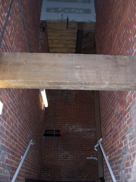
The stairs back into my place. That beam is huge - and probably worth a fortune.
The motivation for tearing down many of these factories is to salvage the wood
from when trees big enough for beams like that still existed.
Well, that was a nice walk - hope you learned something.
JAM is the name of a neighborhood just outside of the core
downtown. The acronym stands for the three long parallel streets that traverse
it: Jackson, Appleton, and Middlesex. The first two are mill company names, the
third is the name of the county Lowell is in. Residential and Industrial
throughout Lowell's earliest years, during the late 19th century downtown began
to creep into Appleton and Middlesex streets. However, the 2nd half of the
twentieth century was not kind to this part of town. Downtown contracted,
leaving many buildings abandoned
or demolished. As industry left, the same could be said for many of the
factories. Today, JAM is considered a "gateway" into Lowell, being a major way
into and across the downtown. Serious urban renewal dollars are planned for what
can really only be called an eyesore. It's just across the Pawtucket canal from
where I live, so I got up early this morning and went picture taking.
This building is your federal dollars at work: This was the Boston and Maine
Railroad station on Central Street long ago. It has since been a telephone
exchange, a movie theater, and a bowling alley. It got extremely run down over
the years, its towers and roofline removed. The National Park bought it up and
is rebuilding it. Across from it is Middlesex Street.
Middlesex Street. This must've been a movie theater at some point. There are no
movie theaters in downtown Lowell today. This building houses a gym now.
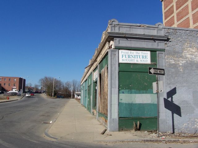
Pretty standard JAM building. This building has been bought and will be
renovated, but for now, it sits next to a halfway house in rough shape.
I love the nice "LOWELL!" banner next to this building less wall.
This wooden structure must be almost 200 years old. It's clearly condemned, I'm
not sure what its fate is.
There's some nice architecture down here - seems this building has been at least
sort of taken care of
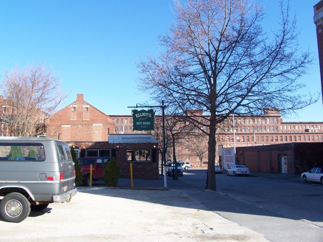
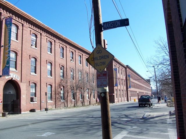
Between Middlesex and Appleton Streets on Elliot Street, named for the preacher
who was the first settler in this area (preaching to Indians) is the 80+ year
old Lowell institution - Elliot's Hot Dogs. The counter is tile, and has the
place misspelled "Elliott's"
Some buildings at the far end of Middlesex Street.
After this, Middlesex and Appleton go into a rotary-like mess called the Lord
Overpass. These
buildings I believe are all being torn down.
Appleton Street is a different story than Middlesex - it's much more
suburbanized (who knows what it was like before), so there's not much to take
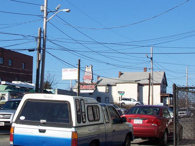
pictures of. However, it is home to the JAMs other culinary institution - The
Owl Diner.
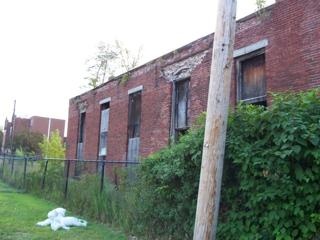
There is a few still-operating factories in JAM - this is Adden Furnature. They
make stuff for dorms.
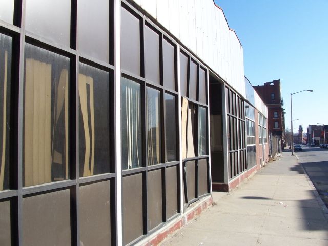
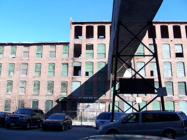
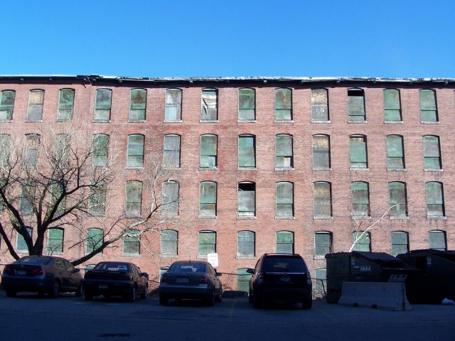
Whole slew of Jackson and Appleton mill pictures - Jackson Street. Notice how
you can see clear through the boarded up factory. This is the front of the mill
with no back in my first picture set. Notice how there's the canal in front of
it and the one behind from the first pictures. One is about 10-15 feet higher
than the other, and that's how they powered the early machines. Note that one of
these buildings is marked 1825 above its door. There
are either new things like a Cambodian day care and cultural center in these
already (The better kept Jackson mills), or in the case of the Appletons,
they're part of the JAM plan.
Dutton/Gorham
On the other side of JAM, there's a few more things to see.
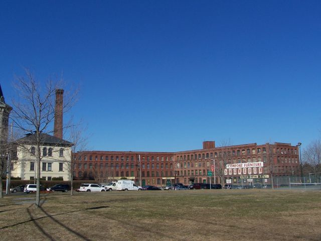
This is Comfort Furniture, the "ugly building with the beautiful furniture".
Very true on both counts. formerly the Hood Sasparilla Laboratory.
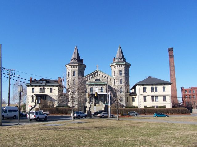
Keith Academy. Now condos, this castle-like building began life as a jail, and
then a boy's school. It faces South Common, where I'm standing
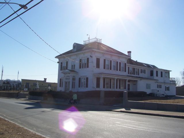
The houses on South Common are very nice. This one is a funeral home, I'm not
sure what's in the rest. Rough part of town and has been for years - too bad.
Triple Decker's near South Common at Gorham Street. This is the beginning of the
Back Central neighborhood.
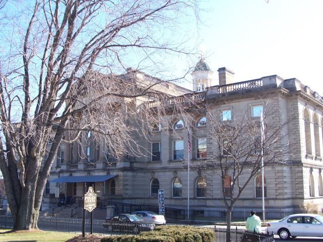
Middlesex County Superior Courthouse - the court in the story.
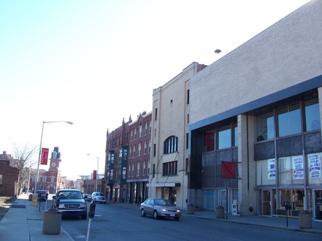
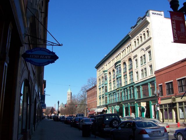
Downtown
Back downtown, the canals are refilled! It's amazing how much better this looks
on a nice day with the water present.
Merrimack Street, Lowell's main drag. The Hildreth Building and Page's Clock.
The old Bon Marche building (a department store, now Barnes and Noble, a French
Restaurant, and who knows what else.) and City Hall's tower.
Downtown busses look like Trolleys
Palmer St, there's some good food on this block.
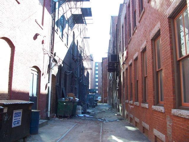
An alley looking from Palmer to Central
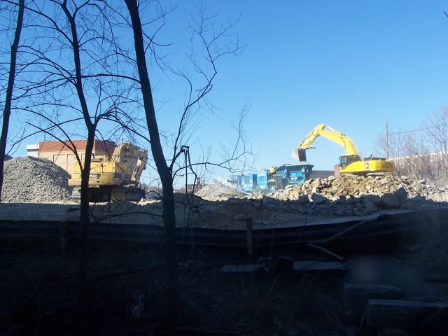
And finally, back in my building, the construction next door.
Lowell, Massachusetts (Part 3)
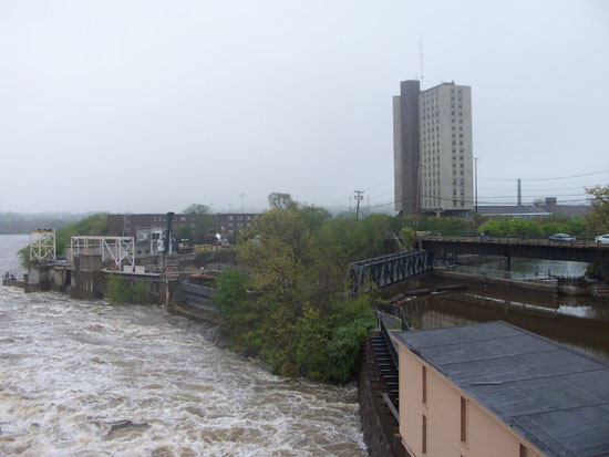
Merrimack Flood, May 15, 2006
After unusual amounts of rain in the city and upriver in early
May of 2006, Lowell suffered one of its worst floods in history. On the 15th,
the Merrimack crested 8 feet above flood stage at Lowell, causing significant
damage from Manchester, New Hampshire downriver to Haverhill, Massachusetts.
However, an eight-foot flood is more of a spectacle than a real issue to most
people, so my girlfriend and I took the afternoon off to go take some pictures.
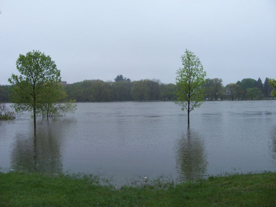
These are before and after pictures of a park right on the
bank of the Merrimack behind the Pawtucket Dam. This is very low-lying land, and
is one of the places where the flood was the most dramatic. As you can tell, it
wasn't that bad, but floods here virtually never happen. The pictures
obviously don't capture the roar of the water falling over the edge of the
falls, which are a good 1,000 feet away and only 10 feet high.
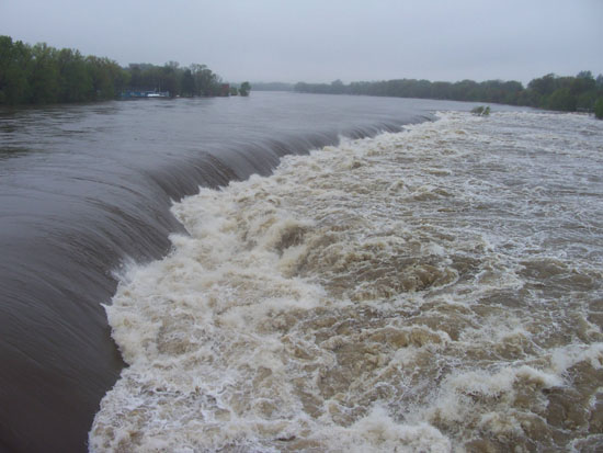
These are the falls, before and after. Somehow we failed to
capture how many people were standing on the bridge here. There was Boston news
crews and everything. Again, the sound of that much water going over the falls
and the sight of how fast the Merrimack was moving was impressive. Remember that
Lowell was built because of these falls and the fast-moving volume of water that
goes over them. In a serious flood, it's really something else.
The "Pawtucket Falls" you see here are actually largely a
man-made dam, made to channel the Merrimack into the two enterances to Lowell's
canal system. The actual falls are more of a series of rapids a mile long that
begins with this dam. You can see in the first picture that the dam is capped by
metal poles holding back wooden planks. When there's too much water, the planks
burst, as a safety mechanism to keep the canals from topping over. In that
picture, they're almost completely gone after the winter. In the second picture,
they must've all burst. What you don't see is between the two, the army corps of
engineers had just about finished replacing them all. They also maintain dams
upriver meant to hold back water to keep the Merrimack at an even level.
Originally the upriver dams were to store up water to keep the mills running
year round. After the 1936 flood - the worst in Lowell's history - more dams
were built that would supposedly prevent a flood like this from happening again.
I'm not sure if it was because this was brought on by rain and not a spring
thaw, but I don't think they worked...
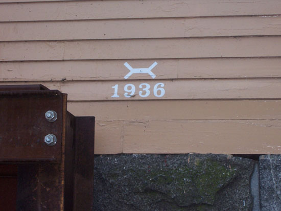
The white line in the third picture is on a gatehouse that
controls the flow into one of the canals. That line was the water level in the
flood of 1936 - it's 10 feet higher than the highest the river reached this
year.
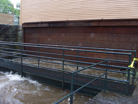
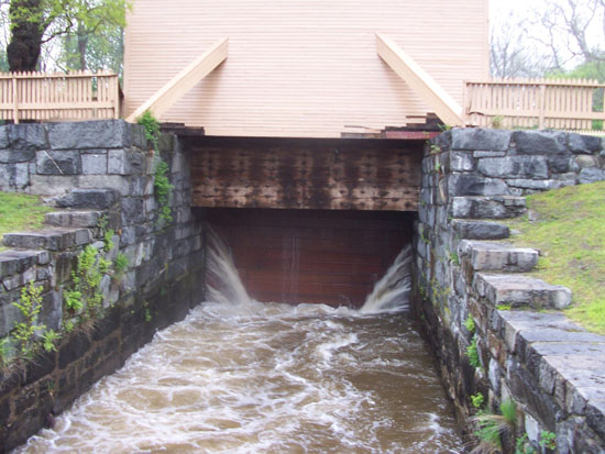
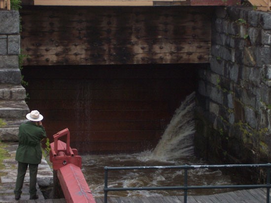
This is the Francis Gatehouse, which is a little behind the
Pawtucket Dam. The first picture is from March, like many of the other before
pictures.
In the second picture, you can see a large metal bulkhead has
been put up against the gatehouse to block the canal. In the third picture, you
can see the original wooden gate is up, and water is bursting around the seams
of the bulkhead. In the 4th picture, you can get a sense of how big this gate
is.
Around 1850, James Francis realized that the Merrimack did
occasionally flood, and the canal system that went right through Lowell had no
mechanism to keep the waters from topping the canals and flooding the city.
People thought he was crazy, since the Merrimack had never flooded in the city's
history. So, his gatehouse and huge wooden gate was dubbed "Francis' Folly."
However, in 1852, there was a flood (crested 10 feet above flood stage) and the
gate was dropped, saving the city from a flood. Nobody called it a folly ever
again. In the 1936 flood, the gate was dropped again, but since the city no
longer used the canals to power the mills, it was left down. It again prevented
a flood in the 1938 hurricane (again 10 feet above flood stage). At some point,
it was raised, and hasn't been dropped again - until it was sort of dropped this
year by being replaced with the modern metal bulkhead. So, at 8 feet above flood
stage, we just had Lowell's 4th worst flood in 150 years.
In the 5th picture, you can see that the 1936 flood was well
over the top of the gate. Had the gate failed, a wall of water the height of the
gate would've surged into the city.
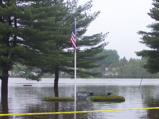
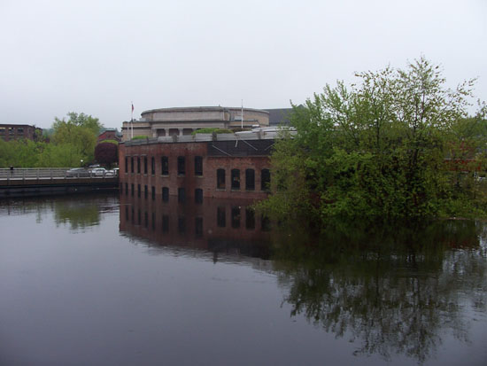
These are the new Lawrence Mills condos. Bit wet now. I hope
that the bottom floor people had flood insurance. The backside of this building
is right on the river.
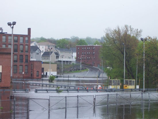
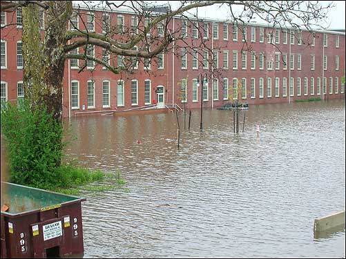
This is the flooding downtown. Most of the downtown is well
above the river, and the canals were held at level by the mechanisms mentioned
above. However, there is this small part that is at the confluence of the
Concord and Merrimack Rivers that is very low-lying. Fortunately, the Concord
flows into the Merrimack from the south, and the rain was mostly to the North
(upriver on the Merrimack). However, the Merrimack was so badly flooded that it
backed into the Concord, this being the result.
The rest of these are pictures of things I have photographed
on the previous pages, during the flood. The canal water was brown and smelled
awful. Fortunately, it didn't take long for the water to go back to normal
levels, and my building didn't really get much damage, although it is right on
the canal.
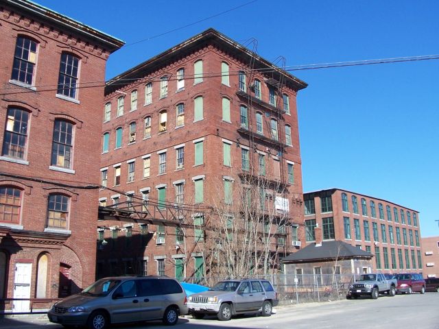
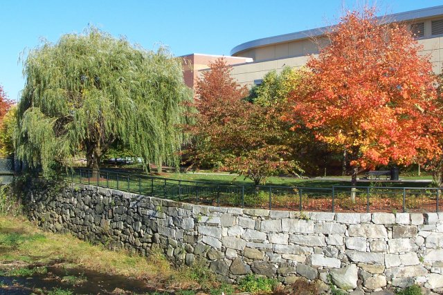
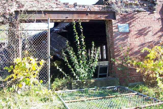
Millyards and Canals (Mostly) October, 2006
Here's a few more pictures of Lowell's millyards. Some are no
longer anything but a brick wall or two, and some are now office complexes and
condominiums. Most of them I've talked about in more detail on earlier pages, so
I'll try to go light on the text.
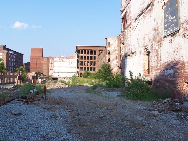
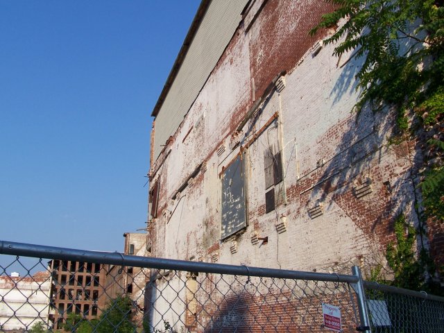
The first group of pictures is the Appleton Mills between
Jackson and Dutton street. They're doing some sort of clean-out here, and
there's a fence up. As I mentioned before on pages
1 and
2, these were apparently purposely partially demolished, but I don't know
what exactly they're going to do with what's left. The brick building in the
fourth picture is the Cottonhouse Lofts, which has been rennovated relatively
recently into living space. However, I've heard that the two large large storage
buildings next door are going to be torn down at some point.
This is the backside of the Boott Mills, which contains a
major exhibit of the National Park (The weaving room is here). These rear
buildings are still being converted into offices and apartments, and it was in
the past few years that the Riverwalk was extended out here. It looks like it's
going to be continued even further to the Concord River. There's a greenway
planned for the banks of the Concord River itself that's just getting off the
ground.
A view of the Massachusetts and Boott Mills from the Hunts
Falls Bridge. You can see a lot of the Mile of Mills from this bridge, when
you're not trying to get a picture out of a moving car.
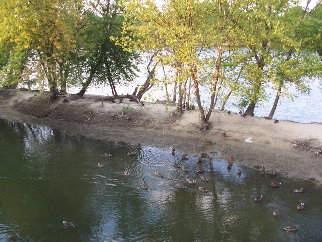
These ducks were living in this little pond separated off of
the Merrimack. I think that the sand that closed this water off was probably
moved by the
flood... along with all kinds of other things.
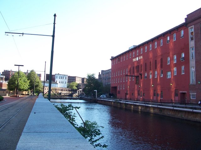
This is the Eastern canal just off Merrimack St - these
buildings front Prescott St. A few of these buildings belong to the Lowell
Sun, which is the local paper. However, they're supposedly moving out of
downtown and over to the American Textile Museum Building on Dutton Street. More
condos? Will the market support it?
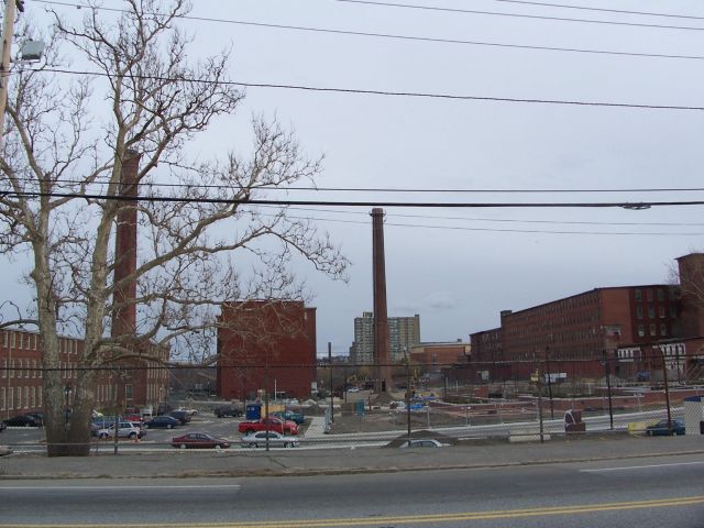
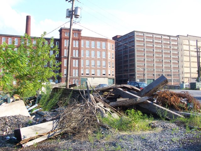
The Lawrence Mills. You can see how some buildings are built
directly over canals, and how empty this yard looks ever since much of it burnt
down 20 years ago. There are still some massive boarded-up buildings on this
site that are looking for new uses.
The Western Canal, which runs past the Lawrence Mills and the
Tsongas Arena. There clearly used to be some structures here, I'm not sure if
they belonged to the Merrimack or the Tremont mills. This site is very close to
the riverwalk, and has landscaped overlooks. It's probably the most "returned to
nature" site in the city and it is fairly relaxing to just come here on a nice
day and watch the little waterfalls and the willow trees.
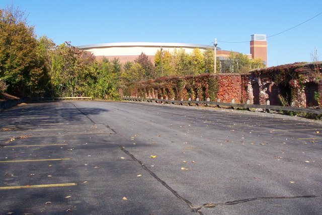
When Lowell held the World Curling Championships at the
Tsongas Arena, this thing was out in front.
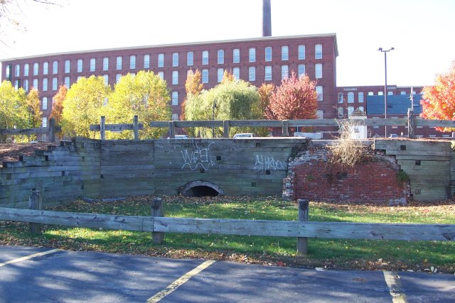
These five pictures show that this parking lot for the
Wannalancit Mills is in what looks like a basement for the old Tremont Mills.
The first picture is the outside, the next four are on the inside. I like the
ivy. I couldn't get a very good picture, but the fifth picture shows tunnels
running under the lot. Are these the remnants of waterwheel raceways?
Honestly not sure what's going on here. In front of the
Tremont Mills.
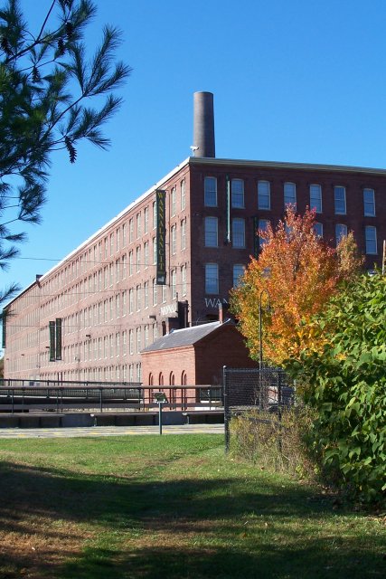
These are the Wannalancit mills. Until the 1980s, this was a
textile plant still - and used weaving machines that were from the 1920s or so.
Workers from Columbia were brought in, since they still knew how to operate the
machines, and would stand the awful conditions. The National Park has the
Suffolk Turbine Exhibit here, which is a pretty cool little tour.
The Lawrence Mills smokestacks.
The Northern Canal in front of the Wannalancit Mills - The
largest and last built (around 1850) canal in town.
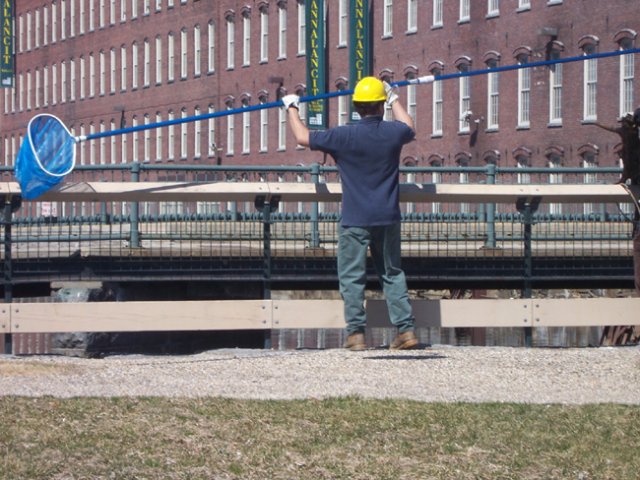
And someone cleaning it! The complexities of the ownership of
the canals is a well-known issue in the city. For example, the Suffolk Turbine
Exhibit doesn't fully run because of a leak in the canal walls may have damaged
some equipment. I believe the description was that Boott Hydroelectric owned
water was leaching through National Park owned walls, through city owned land,
and into the walls of a private building...
The
Lowell Cemetery dates to the 1840s, making it the fourth oldest garden
cemetery in the United States. Older than any public park in the city, this
landscaped cemetery on the banks of the Concord River is as much a walking park
as a burial ground. Some of Lowell's wealthiest and most famous names are buried
here, often under huge and elaborate monuments. The cemetery originally had
lakes and everything, which are now gone. However, the hilly and landscaped
environment is still quite unlike the huge flat plots of land the middle class
of the city gets buried in off of Gorham St.
To contact Abandoned But Not Forgotten please e-mail us at abnfco@gmail.com with any questions or submissions you may want to contribute to the site.
I DON'T GIVE OUT LOCATIONS. I DON'T KNOW IF THE
BUILDINGS ARE FOR SALE. I DON'T KNOW IF THE BUILDINGS ARE STILL STANDING.
Check out our Forums
Homepage